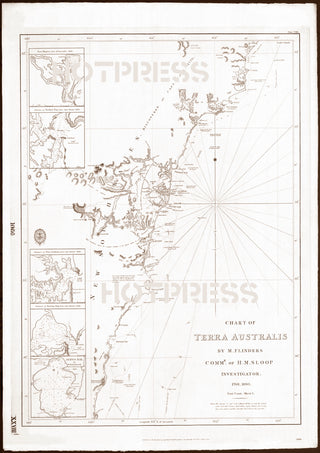
1814 Chart of the East Coast of Terra Australis, Sheet 1
Description
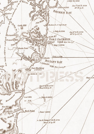
Beautiful chart of the eastern coastal areas of Terra Australis, primarily showing the surveys by Matthew Flinders in that area between 1798 and 1803. Additions to the map were made in 1831.
The original of this map is from the Chart of Terra Australis by Matthew Flinders. Published as the Act directs by Captn. Hurd R.N. Hydrographer to the Admiralty 1st Jany. 1814, 1831.
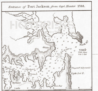
Note: the surveys of Captains Cook and Hunter, Mr Bass etc, and the inland parts from Mess Grimes, Barrallier, Cayley, Mehan and Oxley have been added together with other information to the year 1822.
Some points of interest in the chart are :
- 1. Bateman Bay (now Batemans Bay)
- 2. Jervis Bay
- 3. Shoals Haven (now Shoalhaven)
- 4. Red Point (now Port Kembla)
- 5. Botany Bay
- 6. Port Jackson
- 7. Broken Bay
- 8. Port Hunter (now Newcastle)
- 9. Port Stephens
- 10. Cape Hawke
This is a digitally retouched reproduction of the original held by the National Library of Australia. All prints are reproduced without the HOTPRESS watermarks.
Our team of conservators have worked on a high resolution digital image in order to remove blemishes and artifacts such as stains, mould, scratches and damage caused by the handling of the original. We strive to provide authentic representations of the original work that are suitable for enlargements that retain the tones and character of the original.


