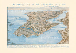
1915 The Graphic Map of the Dardanelles Operations
Description
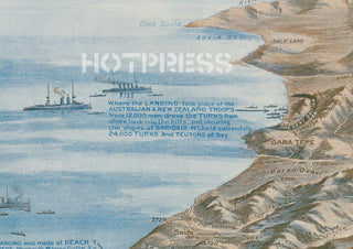
A very detailed map of the Dardanelles Operations in 1915, which included the contribution by the ANZACs.
All text © HotPress
The notes attached to the image state that "This pictorial presentation of the Dardanelles Campaign is especially designed to illustrate the joint naval and military operations in the Gallipoli Peninsula, and to enable the Public to follow the movements of the Allies in their progress to Constantinople."
All prints are reproduced without the HOTPRESS watermarks.
Our team of conservators have worked on a high resolution digital image in order to remove blemishes and artifacts such as stains, mould, scratches and damage caused by the handling of the original. We strive to provide authentic representations of the original work that are suitable for enlargements that retain the tones and character of the original.


