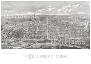
1880 Melbourne Bird's Eye View
Description
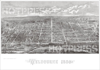
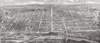
A view of Melbourne in 1880 from high above South Melbourne. This image originally appeared in the Illustrated Australian News, October 1880. Compare this with the earlier version of this engraving of Melbourne in 1871. That earlier engraving has been updated with about 50 new major buildings added; the Spencer Street Railway has been enlarged; the Exhibition Buildings are added, and so on.
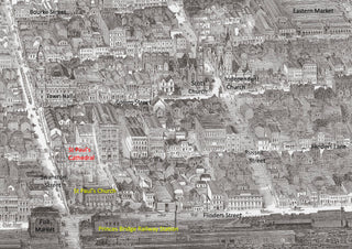
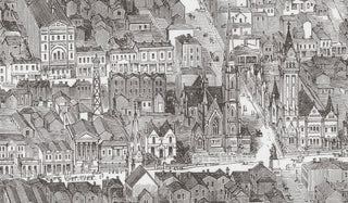
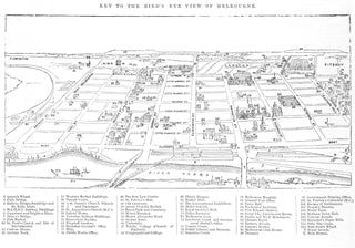
The detail in this engraving is absolutely amazing, providing the viewer with a stunning representation of Melbourne. A large number of buildings and locations are easily identifiable by anyone who knows Melbourne. The picture takes in all of Melbourne starting from the west, where we can see Spencer Street Railway, right across the city to St. Patrick's Cathedral on Eastern Hill. The preparation and engraving must have taken many months of work.
Our conservators have restored this image to a level that this engraving deserves. We have seen numerous versions of this image on other "vintage" sites, but we guarantee that our version is the best one available.
All text © HotPress
The artwork was by Albert Charles Cooke (1836-1902), engraving by Samuel Calvert (1828-1913).
The notes from the State Library tell us that this image is a "Wood engraving published in The Illustrated Australia News."
This is a digitally retouched reproduction of the original held by the State Library of Victoria. All prints are reproduced without the HOTPRESS watermarks.
Our team of conservators have worked on a high resolution digital image in order to remove blemishes and artifacts such as stains, mould, scratches and damage caused by the handling of the original. We strive to provide authentic representations of the original work that are suitable for enlargements that retain the tones and character of the original.
