1814 Views on the south coast of Terra Australis
Description
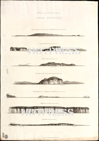
Beautiful drawings of the south coastline of Terra Australis, originally captured in 1802 by Matthew Flinders. Drawn by W. Westall, A.R.A., F.L.S.
7 coastal profiles from Cape Leeuwin, W. A. to Cape Schanck, Vic.
The original of this map is Plate XVII from: A voyage to Terra Australis by Matthew Flinders. Published in London by G and W. Nicol, 1814.
The coastlines that are depicted here are :
- No. 1. Cape Leeuwin, the south-west extremity of New Holland: taken Dec. 7, 1801 at 6h. 30' a.m.
- 2. Cape Chatham: taken Dec. 8 1801at 7 a.m.
- 3. Eclipse Isles: taken Dec. 8 1801at six p.m.
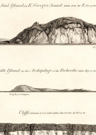
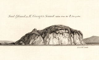
- 4. Seal Island in K. George's Sound: taken from the anchor, Dec. 9 1801
- 5. Middle Island, in the archipelago of the Recherche: taken May 17 1803 at one p.m.
- 6. Cliffs, distant 5 or 6 miles: taken Jan. 26 1802 at five p.m.
- 7. Cape Wiles: taken Feb. 19 1802 at 6h.15' p.m.
This is a digitally retouched reproduction of the original held by the National Library of Australia. All prints are reproduced without the HOTPRESS watermarks.
Our team of conservators have worked on a high resolution digital image in order to remove blemishes and artifacts such as stains, mould, scratches and damage caused by the handling of the original. We strive to provide authentic representations of the original work that are suitable for enlargements that retain the tones and character of the original.


