1814 Views on the east coast of Terra Australis
Description
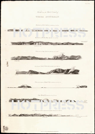
Beautiful drawings of the east coastline of Terra Australis, originally captured in 1802 by Matthew Flinders. Drawn by W. Westall, A.R.A., F.L.S.
The original of this map is Plate XVIII from: A voyage to Terra Australis by Matthew Flinders. Published in London by G and W. Nicol, 1814.
The coastlines that are depicted here are :
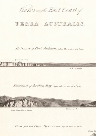
- 1. Entrance of Port Jackson taken May 9 1802 at 11h. a.m.
- 2. Entrance of Broken Bay taken July 22 1802 at 11h. a.m.
- 3. View from near Cape Byron taken July 25 1802 at sunset
- 4. Part of the Great Sandy Peninsula taken July 28 1802 at eight a.m.
- 5. View from the entrance of Keppel Bay taken Aug. 17 1802 at two p.m.
- 6. Cape Manifold taken Aug. 19 1802 at 5h.30 p.m.
- 7. Part of Harvey's Isles with the main land behind taken Aug. 21 1802 at eight a.m.
This is a digitally retouched reproduction of the original held by the National Library of Australia. All prints are reproduced without the HOTPRESS watermarks.
Our team of conservators have worked on a high resolution digital image in order to remove blemishes and artifacts such as stains, mould, scratches and damage caused by the handling of the original. We strive to provide authentic representations of the original work that are suitable for enlargements that retain the tones and character of the original.


