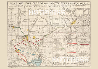
1853 Map of all roads to the Goldfields
Description
A detailed map of the major roads to the Goldfields in Victoria as it was in 1853. This period was the height of the Victoria Gold Rush, and these maps were invaluable to anyone deciding to move to the goldfields. The maps shows the crossroads from one mine to another with indications of various stations. Lithographed by J.B. Philp.
All text © HotPress
Notes from the State Library tell us that this map is "Divided into squares of ten miles, to easily calculate the distance of any new mines when discovered. Includes table of distances."
This is a digitally retouched reproduction of the original held by the State Library of Victoria. All prints are reproduced without the HOTPRESS watermarks.
Our team of conservators have worked on a high resolution digital image in order to remove blemishes and artifacts such as stains, mould, scratches and damage caused by the handling of the original. We strive to provide authentic representations of the original work that are suitable for enlargements that retain the tones and character of the original.

