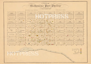
1839 Plan of Melbourne
Description
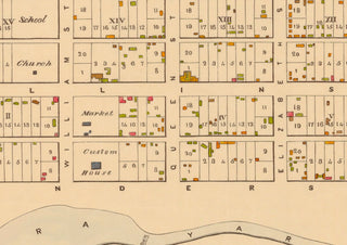
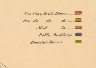
A plan of early Melbourne from 1839, showing all buildings and their locations within the settlement. Buildings are categorised by their height and construction method.
Notes from the State Library of Victoria tell us that this was "Originally published: Sydney : R. Clint, [1839]." The original engraver was R. Clint.
All text © HotPress
This is a digitally retouched reproduction of the original held by the State Library of Victoria. All prints are reproduced without the HOTPRESS watermarks.
Our team of conservators have worked on a high resolution digital image in order to remove blemishes and artifacts such as stains, mould, scratches and damage caused by the handling of the original. We strive to provide authentic representations of the original work that are suitable for enlargements that retain the tones and character of the original.


