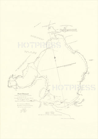
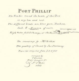
1803 Port Phillip Survey Map - Charles Grimes
Description
In 1802 the Governor of New South Wales, Philip King, instructed his Surveyor-General Charles Grimes to travel from Port Jackson to the Port Phillip Bay area and to explore and survey the area, and report on any suitable sites for settlement. (Previously, Lieutenant John Murray commanding HMS Lady Nelson was the first European party to enter the Bay on the 14th February 1802, and Murray named it Port King in honour of the Governor of New South Wales at the time, Philip Gidley King.)
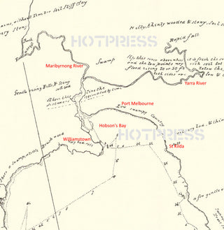
The Grimes party, on board HMS Cumberland under the command of Lieutenant C. Robbins, entered Port Phillip Bay on 20th January 1803. They walked right around the shores of the Bay, found the mouth of the Yarra and proceeded to explore both the Saltwater (Maribyrnong) and the Freshwater (Yarra) Rivers. Grimes explored the Yarra by boat for several miles until he reached another set of falls (Dight's Falls) on 8 February 1803. His survey chart is extremely detailed. Regardless of what people claim about Batman and Fawkner, it was Charles Grimes and his party who were the first Europeans to visit the future site of Melbourne.
One of his party, James Flemming (described as an "agriculturist"), noted on the 26th February 1803 that "The most eligible place for a settlement I have seen is on the Freshwater (Yarra) River." Grimes' chart clearly showed the existence and location of a major source of fresh water, viz. the Freshwater (Yarra) River.
Grimes’ report of the nature of the country around Port Phillip was considered unfavourable by the government in Sydney, and his report was filed away, not to be recovered until 1877, by Mr J. J. Shillinglaw, whilst researching Matthew Flinders' expeditions.
Before Grimes' report (which identified sources of fresh water) had been tabled, Captain David Collins had been dispatched — 27th April 1803 — to form a penal settlement at the place which had been described by Murray as resembling the scenery of Arthur’s Seat (a large hill near Edinburgh, Scotland) and Greenwich Park (a large park in the centre of London).
The party of over 400 people (299 of whom were convicts), lead by Collins, settled near present-day Sorrento in October 1803, unfortunately without the report and survey map created by Grimes, which showed where there was abundant fresh water. Collins chose that particular location in order to keep watch for the enemy French ships that might also enter the Bay. However, at that location they found the soil too poor for crops and no fresh water.
[During the attempt to settle, four convicts managed to escape, one of whom was William Buckley. He survived for 32 years in the bush around Port Phillip Bay, mainly living with the indigenous people. Buckley eventually left the wilderness in 1835, when he introduced himself to Batman's party, who were camped at Indented Head on the Bellarine Peninsula.]
Collins was never really committed to settling in Port Phillip Bay, (as he preferred the area around Hobart in Tasmania) and the Sorrento settlement was abandoned after a few months on 31st January 1804, and Collins and his party relocated to Van Diemen's Land where they established Hobart Town in February 1804.
Matthew Flinders had previously surveyed Port Phillip Bay in 1802, but did not encounter the Yarra. However, he included features from the Grimes chart and acknowledged Grimes' work when finalising his maps later for publication (the Matthew Flinders 1802 map is available on this page).
All text © HotPress
This is a digitally retouched reproduction of the original held by the State Library of Victoria. All prints are reproduced without the HOTPRESS watermarks.
Our team of conservators have worked on a high resolution digital image in order to remove blemishes and artifacts such as stains, mould, scratches and damage caused by the handling of the original. We strive to provide authentic representations of the original work that are suitable for enlargements that retain the tones and character of the original.


