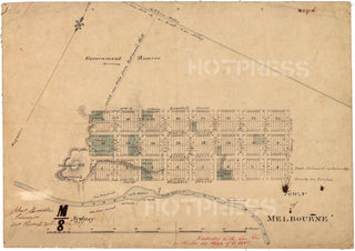
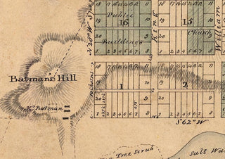
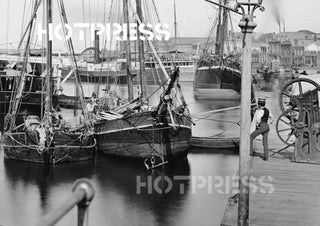
1837 Hoddle's Town of Melbourne Map
Description
An early map of Melbourne from March 1837, drawn by Robert Hoddle.
The location of the Settlement (as Melbourne was known at that time) was selected by John Batman in 1835, and dozens of people from Van Diemen's Land had subsequently moved to the Settlement with livestock and agricultural intentions.
In October 1836 Governor Bourke had sent a small team of surveyors, lead by Robert Russell, to define the orientation and boundaries of the new Settlement. Russell's survey of the location and surrounding areas is shown in this 1837 map.
In March 1837 Governor Bourke visited the Settlement with his Surveyor Robert Hoddle to prepare the Settlement of Melbourne for the first land sales.
Hoddle laid a grid in accordance with established Town Planning Regulations, using Russell's survey as a base for the location and orientation of the Settlement.
During Bourke's visit a number of items were confirmed, such as
- Street widths
- Street names
- "Little" streets or lanes were created
- the name of the Settlement - to be called Melbourne
The first land auctions were held in Melbourne on 1st June 1837 and a second round of auctions were held in Sydney on the 1st November 1837.
All text © HotPress
This is a digitally retouched reproduction of the original held by the National Library of Australia.
Our team of conservators have worked on a high resolution digital image in order to remove blemishes and artifacts such as stains, mould, scratches and damage caused by the handling of the original. We strive to provide authentic representations of the original work that are suitable for enlargements that retain the tones and character of the original.


