1934 Centenary Map of Melbourne
Description
PLEASE NOTE: This is a square print, and the dimensions of this print may require special framing. The sizes that we offer are suitable for a range of IKEA frames.
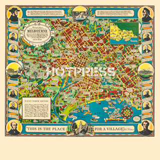
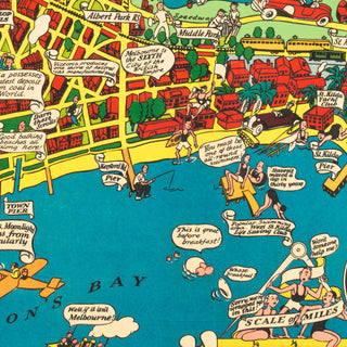
In 1934, Victoria celebrated its Centenary, along with Melbourne's Centenary in 1935. This colourful map was produced for visitors and residents to inform and remind them of our brief but incredible history and achievements.
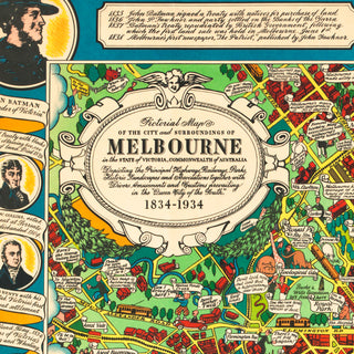
The panel reads : Pictorial map of the City and surroundings of Melbourne in the state of Victoria, Commonwealth of Australia. Depicting the Principal Highways, Railways, Parks, Historic Landscapes and Associations together with Divers Amusements and Customs prevailing in the "Queen City of the South 1834-1934".
‘An animated aerial view of Melbourne City and a humorous illustrated map viewed above the Melbourne Yarra River looking toward the city’s central business district. Includes a border of gum leaves and gum nuts inset with eight boxes with caption titles: Tree climbing; Capt. Lonsdales’ cottage; Warriors; Fishing; Native burial; First police station; Hunting opossum; Hunting birds.’ – Trove
All text © HotPress
Notes from the State Library of Victoria tell us that this map is "Printed l.r.: Designed / & Executed by / O. J. Dale. ; Sub title: Depicting the Principal Highways, Railways, Parks, Historic Landscapes, Divers Amusements and Customs prevailing in the "Queen City of the South". Published as part of Victoria's sesquicentenary celebrations.
This is a digitally retouched reproduction of the original held by the State Library of Victoria. All prints are reproduced without the HOTPRESS watermarks.
Our team of conservators have worked on a high resolution digital image in order to remove blemishes and artifacts such as stains, mould, scratches and damage caused by the handling of the original. We strive to provide authentic representations of the original work that are suitable for enlargements that retain the tones and character of the original.


