1644 Map of Australia
Description
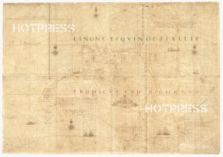
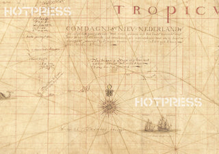
The Abel Janszoon Tasman 1644 Map of Australia (New Holland), showing Abel Tasman's charted discoveries.
The title of the map says "Carten dese landen Zin ontdeckt bij de compangie ontdeckers behaluen het norder deelt van noua guina ende het West Eynde van Java dit Warck aldus bij mallecanderen geuoecht ut verscheijden schriften als mede ut eijgen beuinding bij abel Jansen Tasman."
Title translated: "Map - these lands were discovered by the Company's explorers except for the northern part of New Guinea and the west end of Java. This work thus put together from different writings as well as from personal observation by Abel Jansen Tasman, A.D. 1644, by order of His Excellency the Governor-General Antonio van Diemen."
The Tasman map shows remarkably accurate sections of the Australia's western and northern coastlines, and forms the basis of most charts produced over the next 100 years until Captain James Cook’s Endeavour voyage charted the east coast of Australia in 1770.
This is a digitally retouched reproduction of the original held by the State Library of New South Wales.
Our team of conservators have worked on a high resolution digital image in order to remove blemishes and artifacts such as stains, mould, scratches and damage caused by the handling of the original. We strive to provide authentic representations of the original work that are suitable for enlargements that retain the tones and character of the original.


